
Miles Hiked: 10
AZT Progress: 703.7
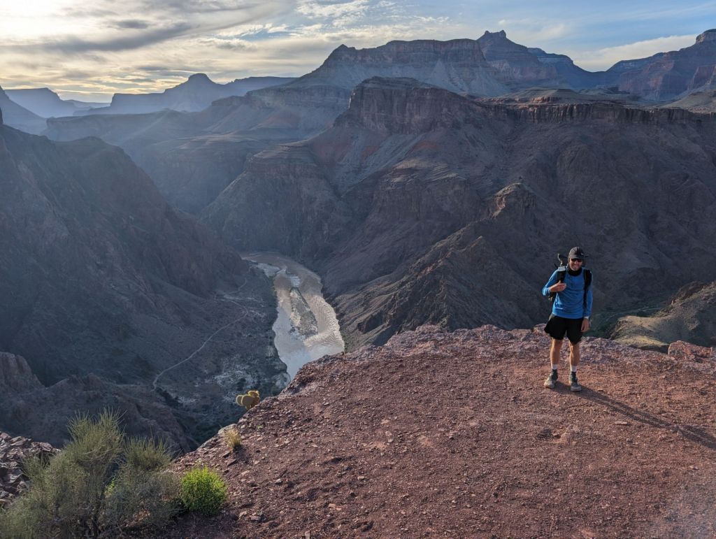
I could barely sleeping for some reason last night but my alarm went off at 4:45am so I could get up and go see the Grand Canyon for sunrise. Honestly I was so tired and had such a bad headache that I didn’t want to get up at all. I knew I would regret it if I didn’t go. I walked about a mile from my campground to the South Rim of the Grand Canyon. It was dark and I had a hard time finding a direct path there. My body felt surprisingly stiff and my feet still ached from yesterday’s long pavement walk. Sunrise was nice but I think I missed the peak of it. Walking back to my campsite still a bit cold, I made a plan for the rest of my day. I laid down in my sleeping bag for 30 more minutes before walking over to the shuttle bus to take a ride to the bright Angel Lodge where I got huevos rancheros as well as a few cups of coffee for breakfast. At 8:30am I went to the backcountry office to see what permits I could get.
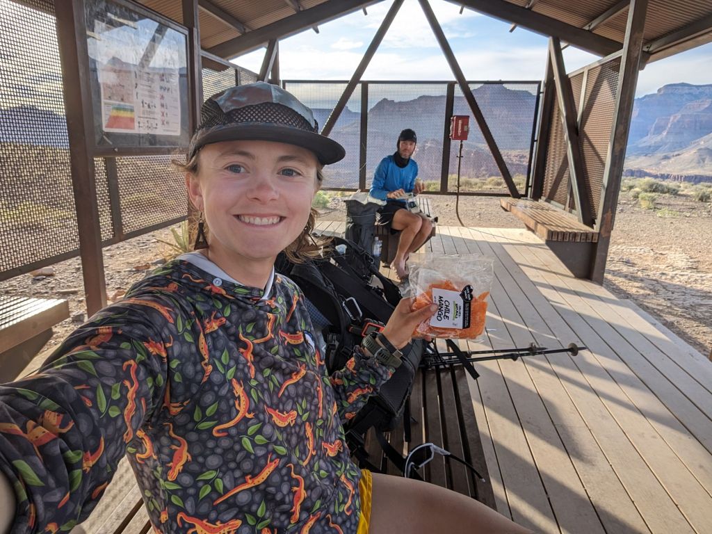
The backcountry office was so nice and helpful for getting my permits. I was allowed to camp at any of the campsites I wanted to that were along the AZT, these included Bright Angel 7 miles from the south rim at the bottom, cottonwood which is 7 more miles past bright angel and the North Rim. Originally I thought I would want to embrace the challenge of hiking Rim to Rim in one day and sleeping on the north rim. It was way too late to start that hike today and I wanted to make at least some progress on the trail as well as have time for camp chores, I have also been so cold lately that the chance to sleep somewhere warm and lower in elevation at the bottom of the canyon sounded amazing. I decided to book a permit for the bottom tonight.
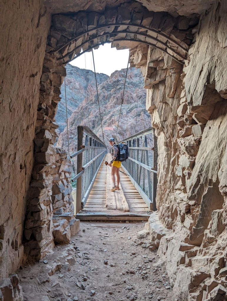
I got back on the shuttle bus to the campground and began all my chores. I packed up my backpack and walked to the camper services building to take a shower and do my laundry. It was here that I met up with Martin again who also booked a permit for the bottom of the Grand Canyon tonight. We decided to hike down together starting at 2pm. Before leaving the South Rim I got lunch with Martin and two other hikers at the Deli. With an ice cream cone to go Martin and I started walking along the south rim to the south kaibab trailhead. The actual AZT follows a paved bike path next to the main park entrance road but martin and I decided that the extra miles along the south rim would be worth all the views. It wasn’t until 3:30 pm that we made it to the South Kaibab Trailhead and started to hike down into the canyon after filling up on water from a spigot at the trailhead. The south kaibab was epic from the first step. The trail immediately begins to steeply descend the south rim wall via a series of switch backs tucked into an inlet of the wall. The trail was wide with big steps divided with wood or rock. The construction was impressive and epic however I needed to pay close attention to my steps as to not trip. My heavy backpack weighed on my joints as the decent continued. I took breaks every two miles just to give my knees a rest. Martin and I both took a plethora of pictures. I joked that I took more pictures on the South Kaibab trail than the entire rest of the AZT. After getting past “Oo Ahh Point” only a mile into the trail, the crowds up people we passed going back up thinned out significantly. Everytime we got one of the popular turn around points with a nice lookout and break spot the crowds would thin even more and eventually we barely saw anyone. Cedar Ridge, Skelton Point, and The Tip Off were the notable viewpointa, break locations, and turn around spots after Oo Ahh Point. On Cedar Ridge the trail literally followed a canyon ridge with drop offs on either side but the trail was incredibly wide here so it wasn’t scary like it might sound. Although the trail was descending almost 5,000 feet in 6-7 miles, there were still some flat parts here and there which made for the grade to be steep occasionally but really the trail was so well built with many switch backs it never felt too crazy like the steep trails at home that I’m used to. From the Tip Off you can get a good view of the Colorado River and both the bridges in the Canyon that cross it, they are probably less than a mile apart. The Tip Off marks the final descent to the Colorado River. Right before going over the amazing suspension bridge, the trail goes through a little tunnel. The river under the bridge was a sage green color, very wide, and looked like the current was strong and fast. We could see some hikers sitting on the beach on the Northern shore.
Bright Angel campground was only a half mile from the river tucked into a narrow side canyon with a gushing stream flowing through it. We walked to the AZT Thru hiker campsite at the very North end of the campground. Almost every spot was filled with people. I was so happy to set up camp somewhere warm well before sunset today. No tarp needed tonight I slept under the stars. I started to write my blog before bed but fell asleep after one paragraph.
Happy Trails!
-Early Bird
