7/18/2026 Day 1
Miles: 15.5 Vert: 4,200 feet
This morning I woke up before my 5:30am alarm cozied up on the back seats of Lauren’s truck. I opened the door to a stunning view of the Tetons. We lucked out with a free camping spot at a trailhead behind Togwotee Lodge. The two of us got ready for the day, grabbed coffee at the gas station and headed to Trail Lakes Trailhead outside of Dubois where we were due to catch the Wind River Shuttle at 8am. I made sure my phone GPS maps on Gaia were all up to date, and I had a set of the paper maps and a printed copy of play by play instructions for the Wind River High Route written by Andrew Skurka on deck. We did one last pack up of our gear before hopping aboard. Ice axe, spikes, emergency blanket, 8 days of food, shelter, water treatment, and mosquito warfare supplies all in check. There was only one other hiker on the shuttle. A middle aged man named Mohammed from Canada (just north of Detroit). We drove two hours to the Bruce Bridge Trailhead stopping at the gear shop in Lander on the way so we could all purchase the $60 (one day) permit for the wind river tribal reservation section that our route passes through.
Ever since I thru hiked the CDT in 2021, I’ve had the Wind River High Route on my bucket list. The Wind River Range is definitely one of the top ten destinations I’ve been to in over 10,000 miles of backpacking. This range was the first time I experienced very remote high alpine terrain and the only thing that has ever come close in comparison is the Sierra. In 2021 my hiking partner Dylan and I carried +7 days of food from the highway 28 crossing near Lander to the highway crossing outside of Dubois. I remember it being a very challenging and eye opening experience. I had considered doing the high route then, but ultimately deemed it out of my wheel house and even though I was in plenty good enough shape with well over 1,000 CDT miles under my feet that year. The high route is definitely an intimidating backcountry objective even to someone with so much experience. I’d consider it a graduate level backpacking trip. As you will learn over the course of this blog, the majority of the route is off trail in technical alpine terrain and requires excellent navigation skills. I am so lucky I was able to join Lauren on this trip so last minute. I don’t take the choice of a partner on this route lightly. To be honest this is not something I would enjoy attempting alone but finding someone with a matched level of fitness, experience, risk tolerance, enthusiasm for and knowledge of what this sort of challenge entails is not exactly easy.
Lauren and I set off from the Bruce Bridge Trailhead shortly after 10am. The morning sun was baking us for the first hour and I struggled massively under the weight of my backpack with 8 days of food. It was so heavy it felt like my spine was getting painfully compressed and I had to stop for five minute breaks more than I’d like to admit. My estimated pack weight with two liters of water was around 38 pounds (I did use a scale before leaving). It began to rain and stayed that way until evening. We could hear the clap of thunder in the distance. A reminder of the afternoon thunderstorm pattern common in alpine areas. We slogged uphill through desert sagebrush terrain that eventually turned into sub alpine. Before we set out, our last weather report didn’t look amazing but there wasn’t anything we could do about it besides be optimistic. I got to learn a lot about Lauren today. Before this the only time I had ever talked to her is when we met at a Fat Ass 50k event in January, went on one single run at the M in Bozeman, and then at Scout Mountain 100 where it felt like I saw her at every aid station either right behind or ahead of me. The first thing I knew about her besides that she is also an ultra runner is that she is obsessed with the winds and was already planning to do the high route this summer.
All in all we did approximately 15.5 miles and 4k feet of elevation gain. This is the one and only day that is entirely on trail. We ended our day at lower Deep Creek Lakes which was absolutely stunning. Lauren planned this camp to give us a night to acclimatize since we will be heading up to 13,000 feet first thing in the morning. Luckily there were some decent tent sites in the short sub alpine fir trees near the lake. Right before we got to our tent site, we saw a group of 10 girls on a NOLS (National Outdoor Leadership School) backpacking trip. They all had enormous packs and big gaiters on and told us they also planned to summit Wind River Peak tomorrow and that they had been in the backcountry for almost a month. It was so fun to see them and made me feel better about how ridiculously heavy my pack was feeling. Getting to lay down at night was such a relief.
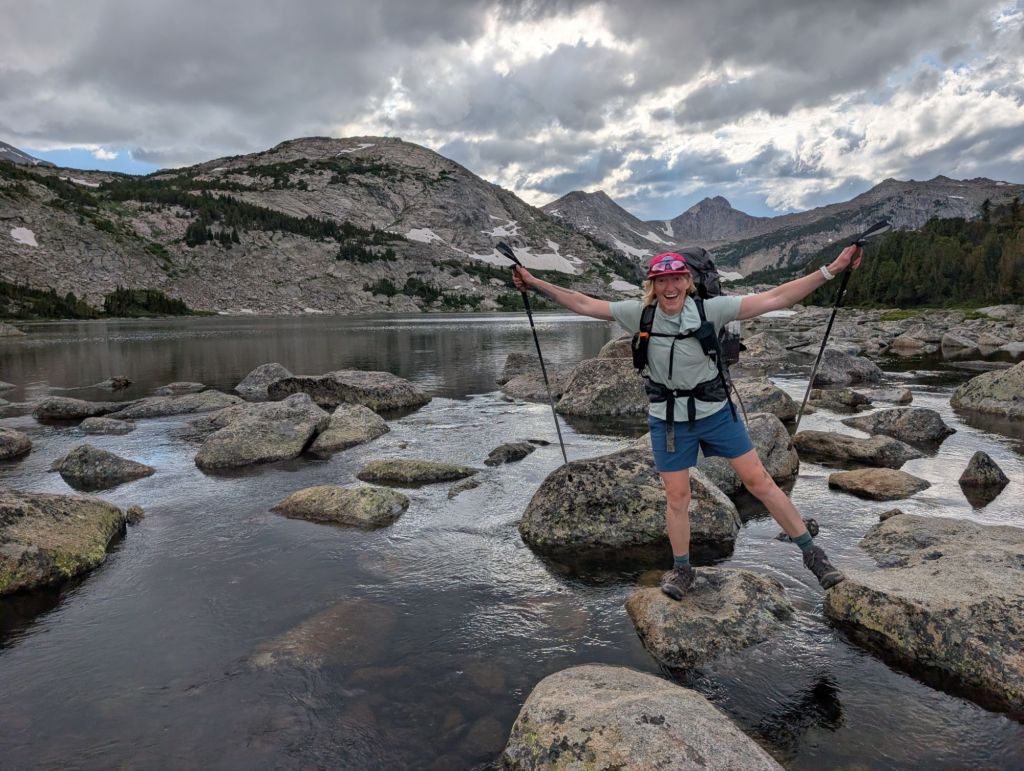
7/19/2026 Day 2
Miles: 14.26 Vert: 4,900 feet
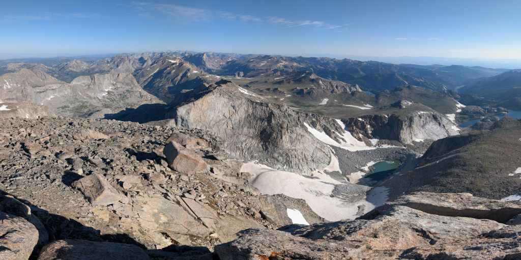
At 3:30am my alarm went off and I slowly started to get ready for our 4:30 am start up Wind River Peak. I forced my breakfast of granola and powdered milk down even though my appetite wasn’t there. Lauren and I slowly picked our way up to the peak in the dark as the sun rose. The transition to true alpine terrain fully began as the ground under our feet turned to tundra and then eventually talus and scree. We enjoyed all the wildflowers and I took several short breaks because of how heavy my pack was – it still felt like it was crushing my spine and neck. The sunrise over the plains to our south was stunning. Between camp and the summit we gained 3,000 feet and crossed at least two snow fields which we did spike up for. At 7:30 am we found ourselves on the 13,179 foot summit overlooking the entirety of our 100 + mile route before us. Wind River Peak is the only peak above 13,000 feet in the Southern part of the Wind River Range. The sky was clear and the mountains were stunning. Most notably Gannet Peak (the highest point in Wyoming at 13,804 feet stood out in the distance with its distinctive horizontal snow field below its summit. Sticking to our plan to have a dance party at the top of every high point on the route I picked a tune for us to have our moment before continuing on to the “most formidable” feature of the route. The West Gully of Wind River Peak.
Steep, loose and long are the three words I would use to describe this gully. I was so nervous about it based on the reports of other Wind River High Route hikers. I was prepared to be very anxious for quite a long time. I knew that completing this route would require me to be out of my comfort zone quite often. In my head I had built this part up to be similar to dropping into a couloir on skis except to be done without the tools for a fun and controlled quick version of descending down a mountain. To my surprise a large cairn marked the entrance and I walked right into the thick of it. As soon as I saw it my anxiety disappeared, replaced with complete confidence in my ability to handle the terrain despite the gully being so steep we couldn’t even see the bottom. This would become a common part of the high route – descending down off trail routes so steep they had their own horizon line below us. I made quick work of getting down the gully so happy that I was actually having some type 1 fun. I laughed to myself about how nervous I was, I had done something similar to this several other times in the past except without a hefty pack on my back to complicate it. I made sure to stay far enough ahead of Lauren that we didn’t have to worry about her knocking rocks down on me. I did fall straight back on my butt several times because of how steep this descent was but I never felt like I wouldn’t be able to stop my fall. The crux of the gully came when we had to do a short class three move down a slab and I had Lauren wait for a second for me to get out of the way since this was the only part that small rocks were projecting past me. Somehow I half jumped down from this feature with both my poles and my ice axe that fell off my pack in one hand. What a celebration it was to be at the bottom. Lauren had planned for the West Gully to take us up to four hours to descend but in reality we were only there for 1-2 hours. This success bought us some valuable time to add some extra miles on the day and get ahead of our itinerary.
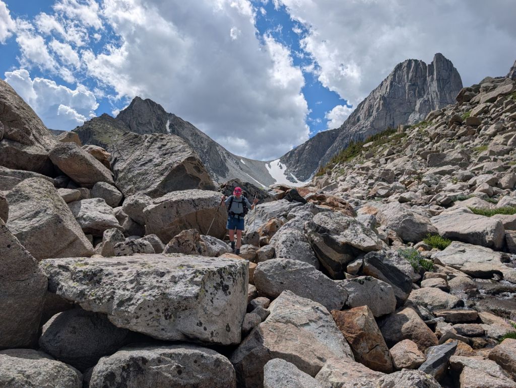
The next objective was to skirt around an unnamed alpine lake completely surrounded by boulders and snow. Seeing an efficient route I picked a contour line and we stuck to it boulder hopping around the lake stopping to lather up with sunscreen as the alpine sun was beating down on us mercilessly. After navigating another steep wall of boulders (luckily large and stable talus this time) we found ourselves walking across a hanging valley following a creek to the foot of Black Joe Lake. Our planned destination for the day was just on the other side by Big Sandy Lake. The walking around this lake was quite easy until we had to navigate up and around a short part of the shoreline through a series of vegetated cliffs. We reached Big Sandy Lake finishing section 1 of the Skurka High Route around 2pm and sat down to have lunch and come up with a plan. This next stretch is the one and only stretch of the Wind River High Route I was familiar with since I overlapped it on a CDT alternate in 2021.
We decided it would be advantageous to camp inside the famous Cirque of the Towers so we continued on up and over Jack Ass Pass with the classic view of towering peaks you have likely seen pictures of before. This area is one of the most notable and popular parts of the Wind River Range. As expected we did see several larger parties here but we were able to pass on by and secure a great campsite early enough. We camped well above Lonesome Lake with access to a great stream of snowmelt. Lauren and I cooked dinner together at 5pm and looked over the paper maps and route description to come up with a new plan for the next day. We were so happy to be so successful from the start of this trip and wanted to keep it that way. In conclusion we decided to try and aim to get over Sentry Peak pass tomorrow if possible. One thing about doing the high route is being prepared for how unpredictable the terrain can be if you have not done a specific feature before. Yes, there are descriptions and yes, you can estimate general mileage and vert but how things look on paper is not always how they translate in reality. At this point in the trip we were still becoming familiar with Andrew Skurka’s vision for the route. As time went on we learned to trust what the guide said despite how impossible things would seem from a distance. We would set goals for the day but being flexible and open to changing the plan was always a requirement. At 7pm we crawled into our tents and I tried to get some quality shut eye. My spine still felt so compressed from my heavy pack and I wondered how many more days it would take until it became lighter. My appetite was not where I had hoped it would be for the first two days and I wasn’t eating as much as I had planned which meant I just had to carry even more food. Before the sunset, I was awoken to the sound of a drawn out rock fall from one of the sheer faces of the cirque towers. At first it almost sounded like thunder, when I popped my head out into the dusk I could see a large cloud of dust from where all the rock was settling. I hoped it was not an area where people were rock climbing in the famous destination.
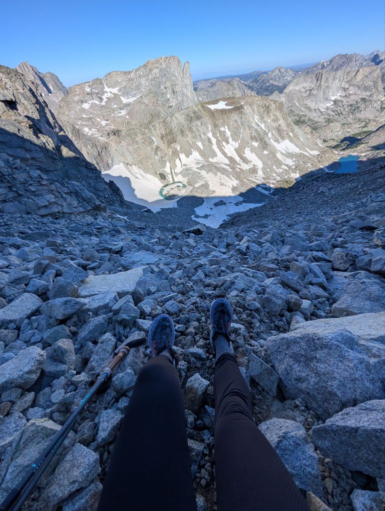
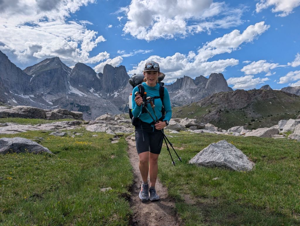
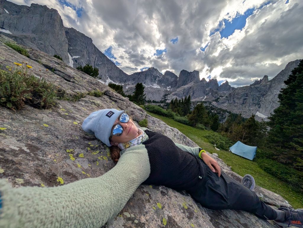
A short lounge at camp soaking up some sunshine before 7pm bedtime.

